

Mining sites are frequently targeted by unauthorized drones for various purposes. Preventing drone intrusion and protecting mine security are critical concerns for mine operators. To effectively counter unknown drones in the surrounding area, early detection is essential.
Applicable Scenarios
Mine security, airport perimeter protection, critical infrastructure, energy facilities, military camps, and other high-security areas.
Product Overview
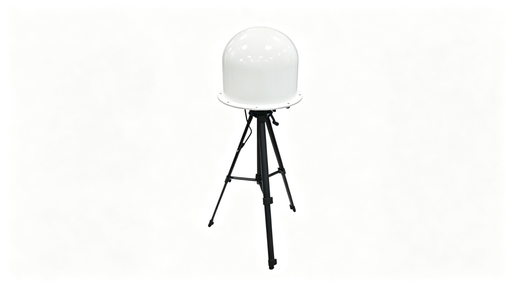
The YKZC02 Fixed Radio Detection Equipment detects drone radio signals within the 30MHz–6000MHz spectrum. It monitors and analyzes signals emitted by drones to identify and locate them. Once activated, the system automatically detects drones and issues audio-visual alerts. It can integrate with a low-altitude security management platform for automated response—using detected location and spectrum data to trigger radio jamming devices, blocking video transmission and forcing the drone to return or land.
Key Features
- Automatic Detection: Automatically detects, identifies drone models, and supports networked positioning and tracking.
- 24/7 Operation: Provides all-weather, all-direction automatic detection and tracking.
- All-Weather Capability: Functions reliably in darkness, fog, rain, snow, and other harsh weather conditions.
- Single-Station Detection: Built-in antenna array with AOA (Angle of Arrival) direction finding enables single-device positioning.
- Precise Identification: Identifies mainstream drone brands, models, serial numbers (SN), frequencies, azimuth, and locations of both drone and pilot.
- Networked Positioning: Supports multi-device networking for non-mainstream drone models.
- Signature Database Expansion: Allows manual or automatic signal collection to update the drone signature library.
- Unknown Signal Logging: Records unidentified drones and sends alerts to the management platform.
- Unattended Operation: No manual intervention needed; automatically logs detection time, frequency, bandwidth, model, and azimuth.
- Whitelist Management: Manually add or remove authorized drones from the whitelist.
- Flight Path Recording: Displays and stores drone flight paths on the platform software.
- Data Export: Stores, queries, and exports alarm logs and historical data.
Technical Specifications
| Parameter | Specification |
|---|---|
| Working Mode | Passive radio detection |
| Detection Target | Drone uplink/downlink data links |
| Identification Mode | Spectrum recognition, Drone ID recognition |
| Frequency Range | 30MHz – 6000MHz |
| Detection Radius | 3–10km (varies by environment and drone model) |
| Detection Angle | Horizontal: 360° Pitch: -20°~70° (precision direction finding) Pitch: -70°~90° (accurate identification) |
| Real-time Scanning Bandwidth | ≥120MHz |
| Azimuth Accuracy | ≤3° RMS (above 2GHz), ≤5° RMS (below 2GHz) |
| Positioning Accuracy | 2m (broadcast message parsing), 10–100m (multi-device cross-location) |
| Multi-target Capacity | ≥40 drones simultaneously |
| Detection Response Time | ≤2s (120MHz bandwidth) |
| Continuous Operation | 24/7 |
| Communication | RJ45, TCP/IP protocol |
| Power Supply | 220V/50Hz AC |
| Power Consumption | ≤75W |
| MTBF | 3000 hours |
| MTTR | 1 hour |
| Operating Temperature | -40°C to +70°C |
| Storage Temperature | -50°C to +75°C |
| Protection Rating | IP66 |
| Dimensions | 600mm × 600mm × 386mm |
| Weight | ≤10kg (including bracket) |
Deployment Options
The device can be temporarily deployed using a tripod for short-term use, or permanently installed on a pole for long-term fixed monitoring.